New TTC map combines subway and streetcar routes
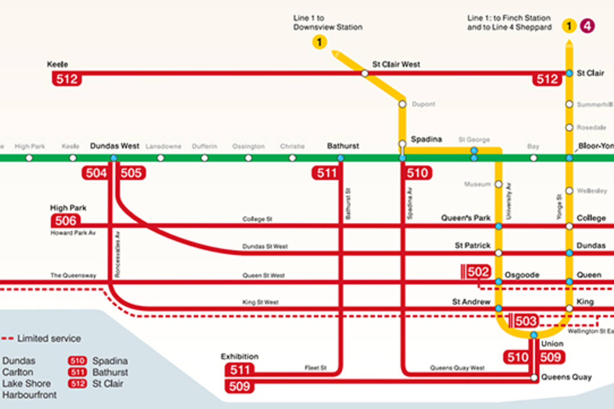
When the first of the new TTC streetcars hit the rails Aug. 31 a new map showing both streetcar and subway routes will begin to roll out. Historically, the TTC has resisted mixing streetcar and subway lines on its subway maps, partly for clarity. The current streetcars do not have maps, for reasons that aren't entirely clear.
"We wanted to make sure people understood where they were on the network relative to other major routes, like subways" says TTC spokesman Brad Ross. "If you're on the 501 you know that you're going to touch Queen and Osgoode stations, or the 504 or 505 are alternatives."
The map,available in full here, marks regular streetcar routes as thick red lines and limited service routes as dots. In order to use the map, a rider needs some knowledge of the road grid, because stops and city streets are left off entirely.
"Our streetcar network is an incredibly important one. We carry 250,000 people a day on it. With the new car, the size of the car, and the fact the operator is in a separate cab, the streetcar network map is really important to help customers navigate the system."
The TTC expects the map to be in all its streetcars in the next few months.
Chris Bateman is a staff writer at blogTO. Follow him on Twitter at@chrisbateman.
拉test Videos
拉test Videos
加入谈话Loadcomments