This is what Toronto's future transit network could look like
Toronto loves future transit maps, whether they becomplete fantasyorpolitical dreaming. The latest one to make the rounds falls in the latter category.
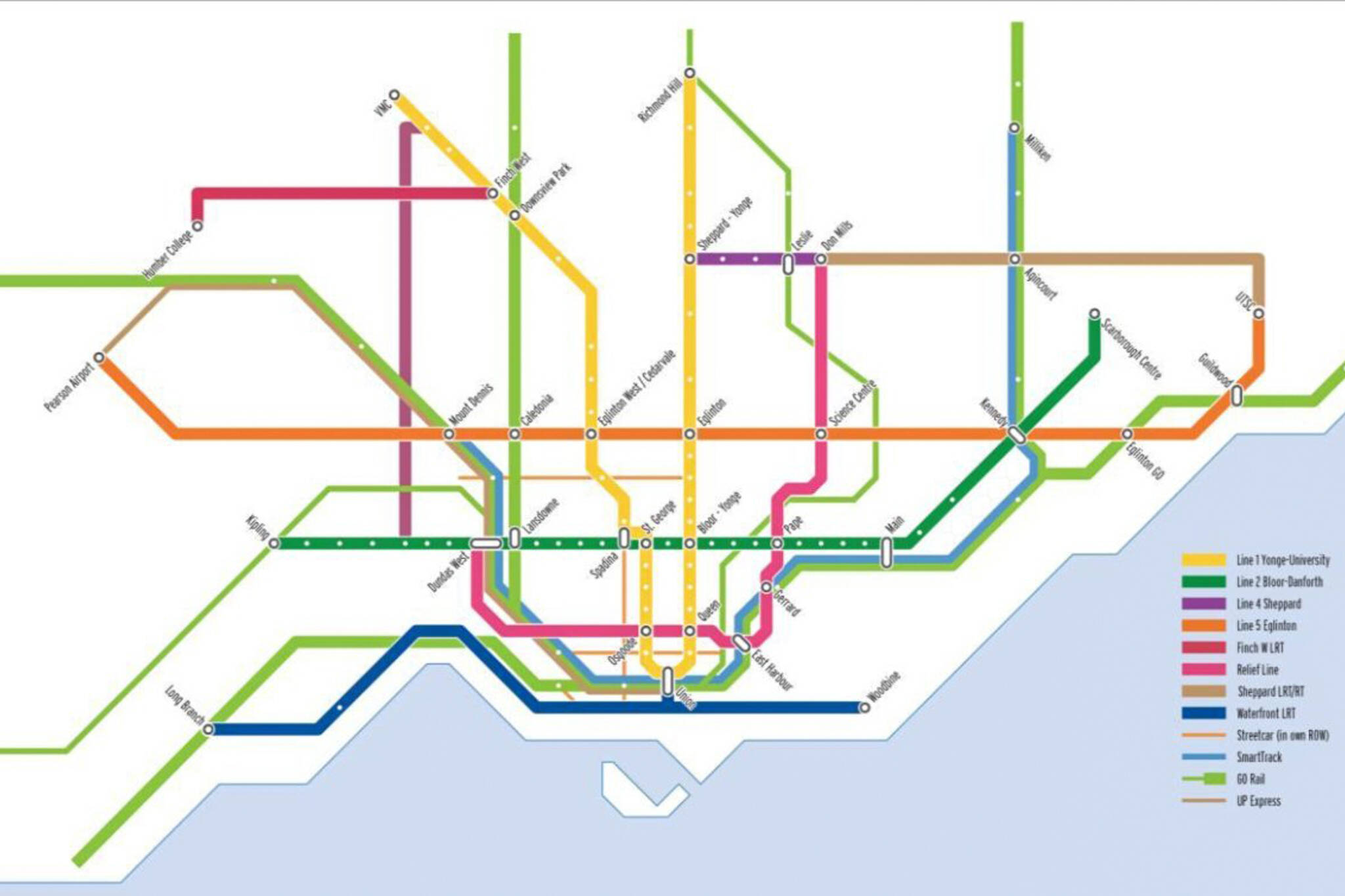
Part of the John Tory-endorsedSmartTrack presentationdistributed yesterday to remind everyone that the transit plan the mayor campaigned on is not actually dead, this slide promises a Toronto area transit system with a whole bunch of dreamy infrastructure.
In addition to approved projects like theFinch West LRTand theScarborough subway extension, this map situatesSmartTrack在a world in which there's aWaterfront LRT, aRelief Line, andKing streetcar ROW(right of way).
From today’s SmartTrack presentation: a new “future rapid transit network” map for Toronto. Guess how old you’ll be when it’s all built!pic.twitter.com/gf0gv8GNPT
— Matt Elliott (@GraphicMatt)October 10, 2017
What's missing here? A timeline!
It's not that the various projects featured haven't been discussed before, but that the funding picture is so up in the air that it's anyone's guess when our transit map will look anything like this. It could be 50 years.
The intention is likely to associate SmartTrack with a robust transit network in general, but the funny thing about a map like this is that it also serves as a reminder that if we had all of these other transit lines, we probably wouldn't be talking about six SmartTrack stations.
SmartTrack
Latest Videos
Latest Videos
加入谈话Loadcomments