Cool new tool lets you see Toronto from above as it looked generations ago
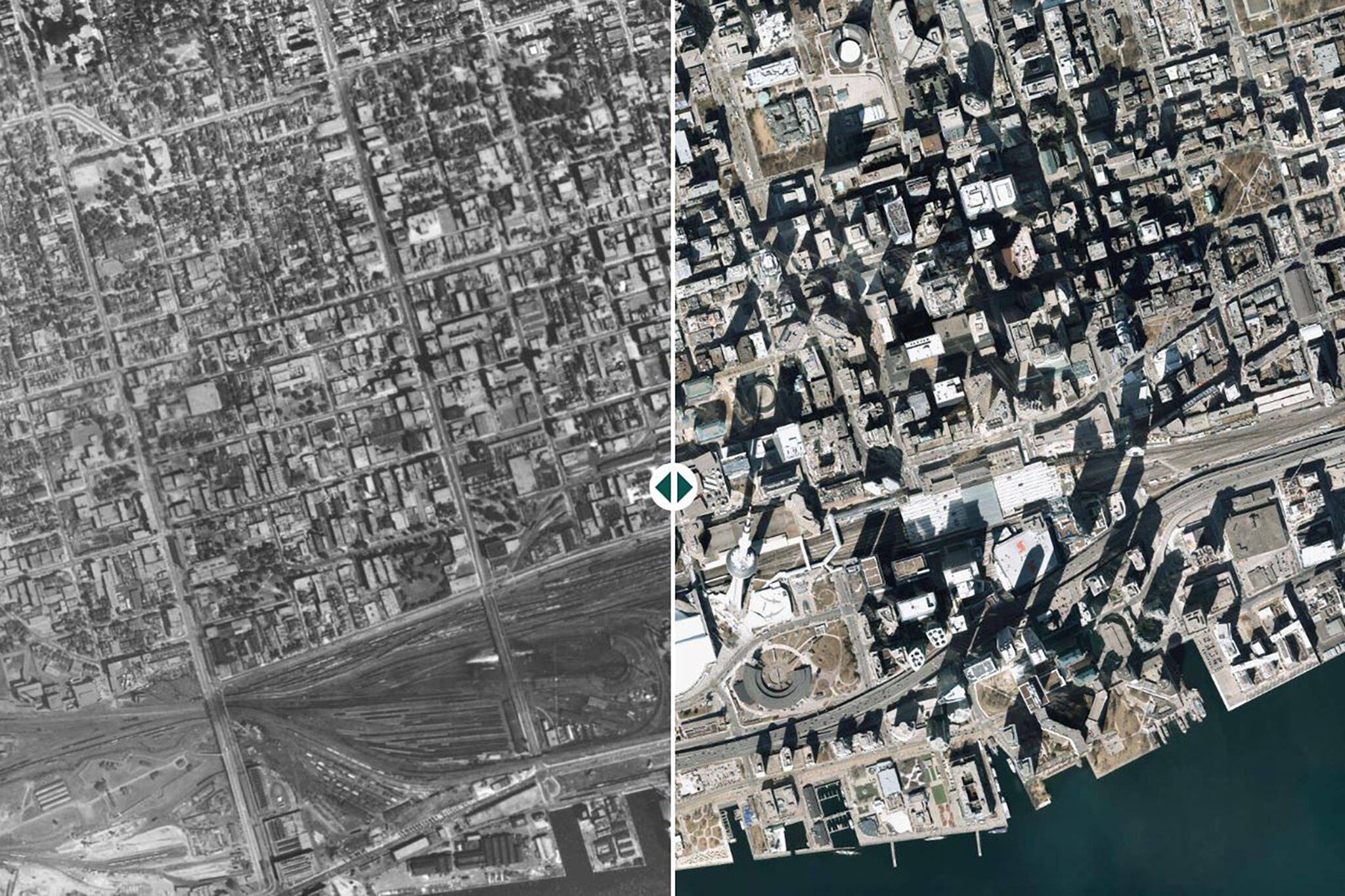
The era offingertip satellite imageryhas really taken the novelty out of aerial city views, but a new tool is putting the fun back in aerial mapping, letting Toronto dive back through the history books to compare our sprawling high-rise city of today with its humble origins.
Thenew websitelaunched last week, described by creator and cartographerJeff Allenas "A simple web app for comparing historical aerial imagery (i.e. air photos) in the City of Toronto," adding that the platform was "built for teaching and research purposes at the [U of T] School of Cities, but made openly available for anyone interested in Toronto history."
An almost identical tool was made available byGoogle-affiliated Sidewalk Labsas part of their ill-fated plans to win over Toronto on a proposed smart city, but that site was quietly taken offline not long after this "city of the future" was scrapped.
For the first time since the previous tool went offline, users can once again scan a slideable-split-screen map of the city, aligning and comparing 2021 satellite imagery with aerial views captured in 1954, 1965, 1978, and 2011 sourced from City archives.
多伦多嗨感兴趣story?@JeffAllenMapsmade a simple website for viewing and comparing historical aerial photographs in#Toronto.
— School of Cities (@UofTCities)December 1, 2022
Check it out here!https://t.co/wDcROE7To0pic.twitter.com/NIK2CNtMY9
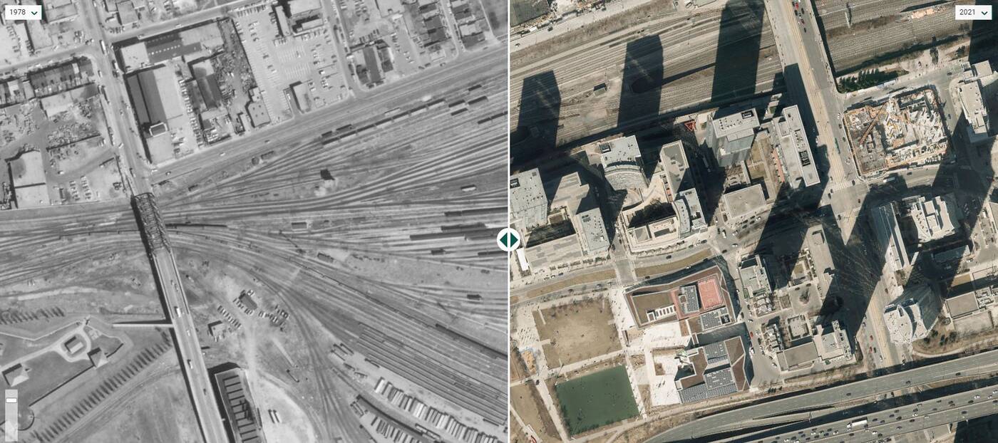
With just a click or a swipe of the finger, you can experience a bird's-eye view of Toronto as it appeared generations earlier. And spoiler alert, there were a lot of rail tracks back then.
In fact, entire neighbourhoods exist in modern Toronto on land that was once dedicated towide swathes of railinfrastructure, like most of the CityPlace-Fort York neighbourhood.
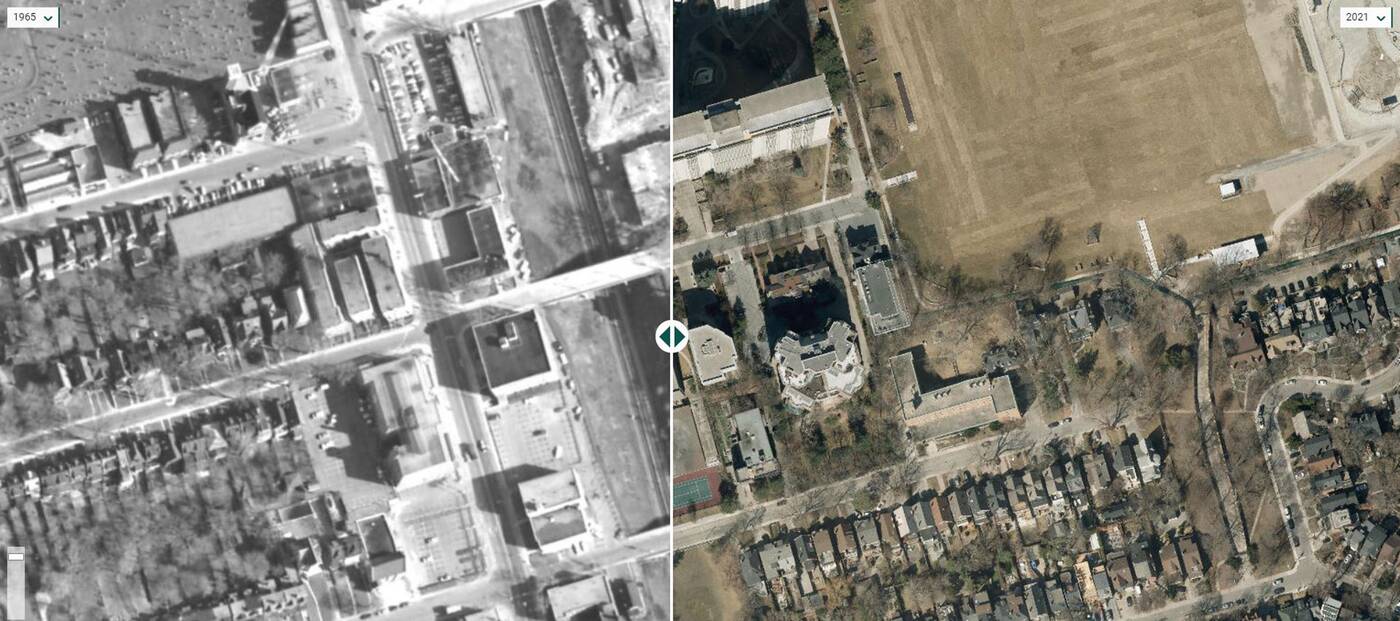
 Other rail tracks may have disappeared, but they still exist, buried out of reach of eyes in the sky. One example is a stretch of the Yonge subway's formerly open trench that wasdecked over in stagesduring the mid-to-late 20th century.
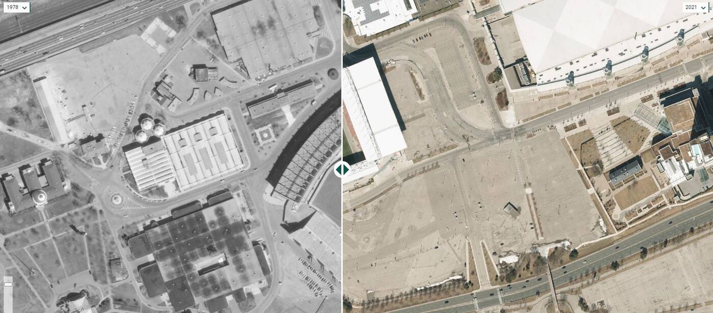
 It's especially interesting to compare the sites of lost landmarks with what replaced them. BMO Field occupies a portion of the hallowed grounds of the formerExhibition Stadiumsite, but you can still see the remaining distinctimprint of the stadium's infieldin aerial views to this day.
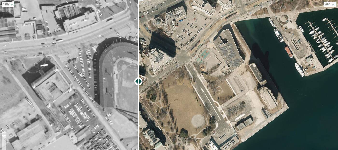
 Another legendary ballpark used to exist at the foot of Bathurst Street. Today, the formerMaple Leaf Stadiumsite is home to rental apartment housing and a public park.
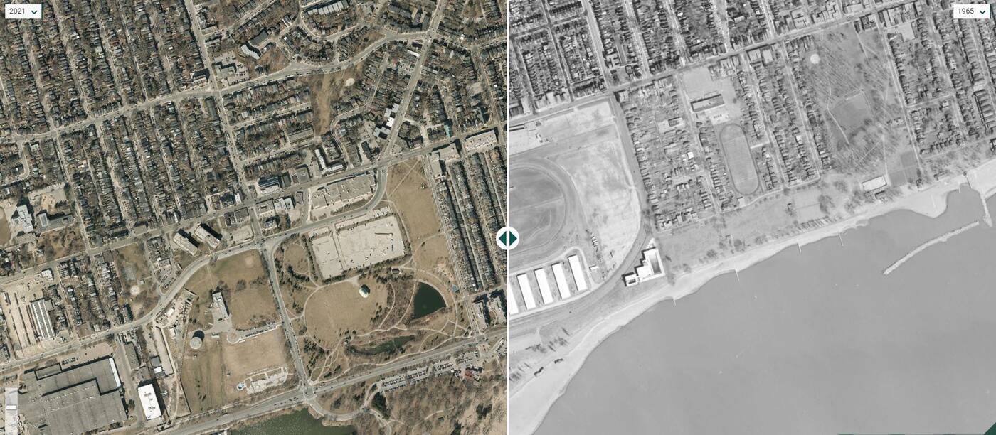
 Other lost sporting venues include theGreenwood Raceway, which was alsoredeveloped with housingand a public park when its operations moved to the current Woodbine Racetrack in Rexdale.
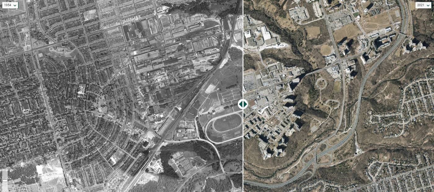
 Okay, just one more lost sporting venue, not that I have a horse in this race (hyuk, hyuk). The lostThorncliffe Park Racewayoperated from 1917 to 1952 in what is now the Leaside area, and an entire neighbourhood now exists on its former footprint.
 Allen tells blogTO that "The Toronto Archives and U of T's Map and Data Library do great work making lots of aerial imagery available for download as well as providing WMTS layers that can be viewed in a GIS."
He says that his goal "was to create an easy-to-use tool to view some of this imagery on an interactive map with minimal effort (be able to easily explore, zoom in-and-out, and pan across the entire city - rather than having to search for and download individual images - or having to open a GIS)."
"I also wanted to easily compare between years (with the slider) to see how places have changed."
While Allen says the tool was created for teaching and research resource purposes for the U of T School of Cities, he "wanted to make it freely available for anyone interested in Toronto history."
"I had seen a couple projects creating similar maps before (Sidewalk Labs being one), but they're unfortunately no longer live - which was part of our motivation as well."
The layered maps provide endless entertainment, but Allen explains that creating the tool "really wasn't a lot of work," explaining that "the City makes the years currently on the map freely available as WMTS layers - I just built the interface and slider (using Svelte and OpenLayers) and linked to these layers."
He expects the tool will continue to grow with additional map layers, saying that a 1947 aerial is next on the docket.
"It'd be nice to eventually have photography from each decade going back to the 1930s - for some years though, it might take some extra effort to stitch the individual images together."
But until then, there are still countless more landmarks — current and former — to compare in this unexpectedly fun way toexplore the historyof Toronto's built form.
Jeff Allen/U of T School of Cities
Latest Videos
Latest Videos
Join the conversationLoadcomments